
Why farmland
Farmland is not empty land waiting for a better use.
It is a set of physical conditions that happen to line up in a few places, concentrated in and around South Morro Hills. This page explains what makes this ground rare, where it is, what is lost when it converts, and how to tell farming from a commercial business that occupies a farm.
Five conditions, one place
Remove any one of these and productivity falls. All five together are why this ground has been farmed for generations rather than abandoned, and why the State of California maps much of it as Prime Farmland, Farmland of Statewide Importance, or Unique Farmland: not any agricultural land, but land whose soil quality and history of irrigated production meet the state's own criteria.
Soil
Sandwiched between Sleeping Indian and the San Luis Rey River bed, this ground has sandy, workable soil built by the river over time. The state's own soil surveys are part of what qualifies parcels here as Prime Farmland or Farmland of Statewide Importance: soil built over millennia, destroyed in an afternoon of grading.
Drainage
Sloping ground sheds water instead of pooling it, part of the water-holding capacity and permeability the state's soil criteria weigh, and it keeps roots healthy and fields workable soon after rain.
Sunlight
A long, frost-light growing season on south-facing slopes allows multiple harvests and specialty crops that colder regions cannot carry, sustaining the irrigated production history the state's maps look for.
Coastal air
The ocean is a few miles west. Marine influence moderates heat and cold and adds moisture, narrowing the temperature swings crops dislike.
Wind
The onshore breeze moves air through the rows, dries foliage, reduces disease pressure, and keeps cold air from settling. It is the least discussed input and one of the most valuable.
The state's Prime Farmland and Farmland of Statewide Importance designations rest on two things only: soil quality, as determined by USDA soil surveys, and a history of irrigated agricultural production. Sunlight, coastal air, and wind are not part of that state test; they are what makes this ground worth farming in the first place, and what sustains the irrigated production the state's designation depends on.
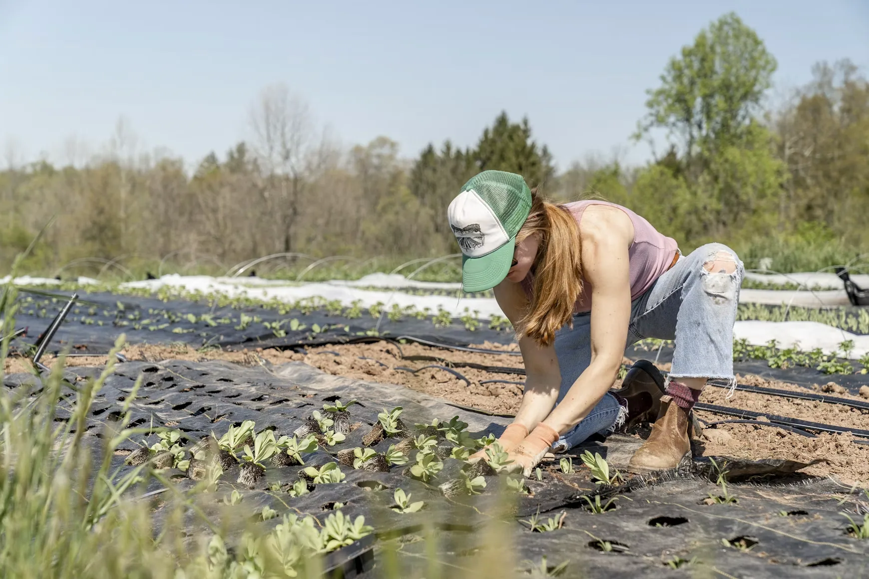
What is at stake once farmland converts
Conversion is permanent in practice. Grading, foundations, and utilities end the soil profile, and land priced for development never returns to a price a farm can pay.
The losses compound beyond the parcel. Neighboring farms lose the shared services, labor, and equipment that only make sense at scale. Rural roads take traffic they were not designed for. Water and habitat systems change. And food that was grown minutes from where it was eaten is trucked in from somewhere else.
Every acre also carries an expectation. Each approval that departs from the plan becomes the precedent for the next request, until the plan describes a city that no longer exists. Once farmland converts, it does not come back; seeing the corridor whole, and the pressure on it, is the first step to keeping it.
Agriculture, and commercial uses that look like it
Farms have always sold what they grow, hosted school visits, and welcomed the public. That is agriculture, and we support it warmly. Oceanside's code draws the line by intensity and by purpose: agritourism is meant to stay subordinate to active, viable farming. The two columns below describe uses, not businesses, and each reader can weigh what they see against the standard the city already set.
Genuine agriculture
- Income comes primarily from what the land produces.
- Buildings, parking, and access serve growing, packing, and selling crops.
- Traffic follows the season and the harvest.
- Soil stays in production; improvements are reversible.
- Retail, tours, and tastings are secondary to farming.
Commercial event use on farmland
- Income comes primarily from admissions, rentals, and hospitality.
- Structures, lighting, amplified sound, and lots serve gatherings, not crops.
- Traffic follows a weekend calendar on rural roads.
- Acreage in production shrinks as the venue grows.
- Assembly-type events in the agricultural zone require a discretionary permit with notice, findings, and conditions.
Intensity sets the price of land. Where high-intensity commercial activity becomes the expected use of agricultural ground, farming has to compete with it for the same acres. That is how farmland can be lost without a single rezoning, which is why Oceanside's code asks that agritourism stay subordinate to farming. See the vision and the code.
The place these choices get made is the South Morro Hills Community Plan, and it is still open.
Sources and methodology
1. Soil classification — add citation (e.g. USDA NRCS soil survey, Oceanside)
2. Farmland inventory and map data — add citation (California Dept. of Conservation FMMP; SanGIS / SANDAG regional GIS)
3. City policy — add citation (Oceanside General Plan, agricultural land use element)
4. Zoning and permitting standards — add citation (Oceanside zoning ordinance)
5. Climate and wind data — add citation (NOAA / CIMIS station)
6. Real-estate listings and permit records — add citation (City of Oceanside planning and permit records)
Placeholders. Link the specific documents you rely on so readers can check every claim on this page. Educational information only, not legal advice. Last updated [date].
Add your voice
We will tell you when the map changes.
Updates when farmland applications and plan milestones appear in the public record, in plain language. Occasional, double opt-in, no spam.
Occasional updates and action alerts. Double opt-in, no spam, unsubscribe any time. We never share or sell email addresses.